Cyrille MdC

FrakturMedia

GIS, transport, society and other analytical ramblings.

How to lie with Charts

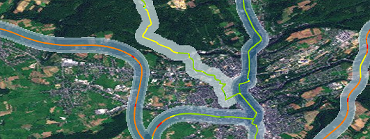
Charts, are a regular component of maps. Just like maps, subtle changes can distort the message that the data has. While maps must lie, by distorting space/scale, charts need not. Yet incomprehension, bias and desire to 'jazz-up' charts usually leads to false 'statements'.

Cyrille MdC

3-Minute Read

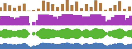
If you’ve never read How to Lie with Maps by Mark Monmonier, now is the time. Since reading this book I have kept an eye out for examples of lying maps and charts. I am often rewarded with examples such as this:

City Evolution

I recently read a journal article my supervisor had co-written and thought “I can replicate this!”. The article clearly laid out a method for creating a model that would distribute houses around a central business district based on the preferences of the agents and other model parameters.

Cyrille MdC

2-Minute Read

The original program on which the publication is based on was written in Java but loving SVG I decided to recreate the model using JavaScript and SVG. I also created a version without SVG using div tags as cells instead for speed comparison testing. Surprisingly, and much to my happiness, using SVG was slightly faster than using the DOM to display square cells.

Friendly Batch Routing

This post presents a web platform easing access to routing directions using the Google Maps API.

Cyrille MdC

2-Minute Read

My work at the University of Luxembourg focuses on developing a residential model utilizing economic theory for agent location. Agents locate depending on many internal (family) and external (environment) factors. An import consideration for any household is a location’s accessibility to public (train station) and private (shopping) services and work. In order to determine the accessibility of a location you must determine the distance, time and/or cost of reaching all desirable locations.

Recent Posts

Categories

About

Some data analysis ramblings on transport and society using GIS, R, Python, and other effective tools.